This walk is cancelled because of rain / wind in the forecast. We plan to reschedule it around the same time (Spring), next year.
Leader: Alina Constantinescu
Meeting Location Details: Alhambra Creek Staging Area (Briones Regional Park) at the end of Brookwood Drive in Martinez. Parking at the meeting point is $3, if the parking kiosk is staffed. The drive from Berkeley is about 35 minutes. If you’d like to carpool, we suggest meeting for rides at the North Berkeley BART station (free parking on weekends). If you need a ride or if you would like to offer a ride, please email Alina.
Distance: 15 miles
Elevation gain: 2,300 ft.
Accessibility: Dogs on leash are permitted on the trails and at the lunch spot, but they can’t go inside John Muir’s house/museum if you decide to visit.
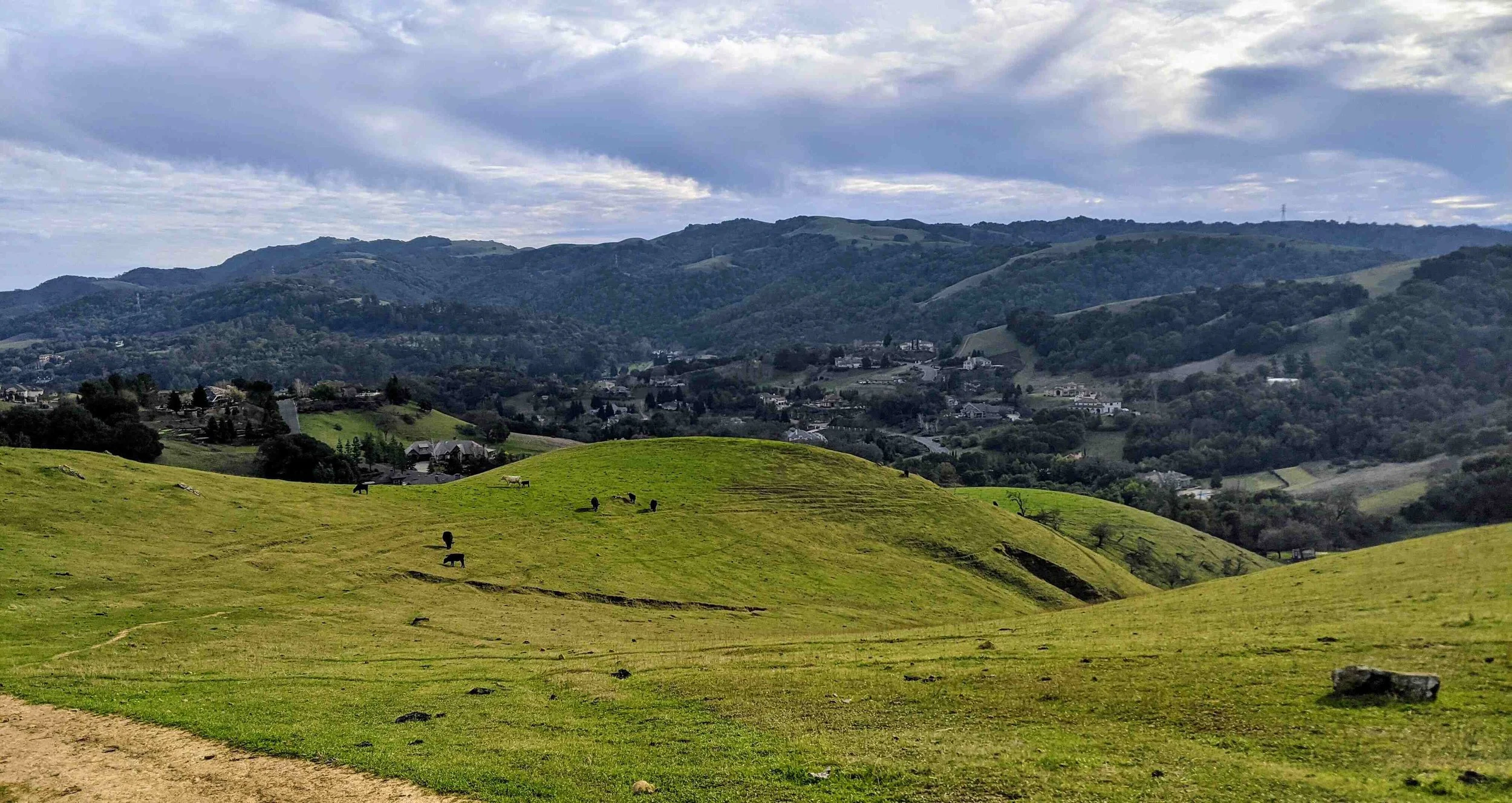
This year’s ‘Long Walk’ explores the less-traveled trails of the John Muir Land Trust. If you haven’t been to this area of the East Bay, you are in for a treat! (And if you have been, some of the trails chosen for this hike, like the little known but marvelous Vaca Creek Trail, may be a first for you, too.) The hike starts and ends in Briones, but the main attractions are the trails in the old Almond, Sky, and Dutra ranches. The views are endless - Mount Diablo appears a stone’s throw away and, on a clear day, the Sierras’ snow glimmers in the distance. As a bonus, our lunch stop is at the John Muir National Historic Site in Martinez where you can explore the visitor center, the orchard grounds, and the home of John Muir. We will take about an hour of ‘free time’ here to either rest or explore, as you wish. Bring your National Park passport if you’d like a stamp at the visitor center.
Our route is a ‘lollypop’ shape: it starts and ends on the Orchard Trail in Briones, with a loop through the John Muir Land Trust ranches. We will hike 9 miles with 900 ft elevation gain in the morning. We estimate we’ll reach the lunch spot about 12:45p, depending on the group. The way back is shorter: 6 miles with 1,400 ft elevation gain. We estimate we’ll be back at the starting point about 4:30-4:45p. Most of the trails are along ‘rolling hills’ with moderate inclines with the exception of one mile of flat walking on the side of Franklin Canyon Road, a 2-lane rural road with intermittent sidewalk coverage where we’ll need to be mindful of traffic.
Bathrooms and water are available at our start/end point and at our lunch spot. There are no other bathroom or water refill opportunities on the trails. Bring at least 2L of water with you. Also bring lunch, snacks, hat/sunscreen, layers, etc. The trails are mostly exposed and the area can get hot. Our lunch spot is shaded (picnic tables in a creekside Redwood grove). We will cancel the hike if the temperature forecast for Martinez is over 75F that day. If that’s the case, we will update the website and send an email out a couple of days ahead.