
Signpost 29 Trails: Take a Hike Without Going Far Afield
Driving on Claremont Avenue in Berkeley, between Grizzly Peak Boulevard and the Claremont Hotel, you may have noticed three black-and-white signposts numbered 27, 28, and 29. UC Berkeley owns more than 200 acres in Claremont Canyon, and they installed the signposts as geographic markers in case of wildfires. (Signs with lower numbers begin near the football stadium and continue up Centennial Drive to, and along, Grizzly Peak.)

Map of Signpost 29 trails, off of Claremont Avenue.
Signpost 29, about 1.25 miles past the hotel on the south side of Claremont Avenue, is also the gateway to three short but interesting hiking trails. They offer a convenient way to take a quick hike or to access other trails for a longer, more challenging one.
Volunteers from the Claremont Canyon Conservancy, in cooperation with UC, built the two shorter trails, Summit House and Willow. In addition, the Conservancy recently completed an 0.4-mile link to the longer Gwin Canyon Trail. The top two-thirds of that trail belong to the East Bay Regional Park District.
Some parts of the Signpost 29 trails are narrow and rutted, with patches of poison oak and brambles along them, so be sure to wear long pants and long-sleeved shirts as well as closed-toe shoes with good treads.
To explore the area, park on Claremont Avenue near the signpost. Walk onto the field beyond the locked gate, where you’ll find a helpful map of all the trails in Claremont Canyon. Summit House and Willow Trails form a 1.3-mile loop, and the 1.1-mile Gwin Canyon Trail ascends to Norfolk Road in the Grandview neighborhood of Oakland.
Contrasting Sides of Claremont Canyon
Before you set out, notice how the vegetation around you contrasts with what’s growing on the other side of Claremont.
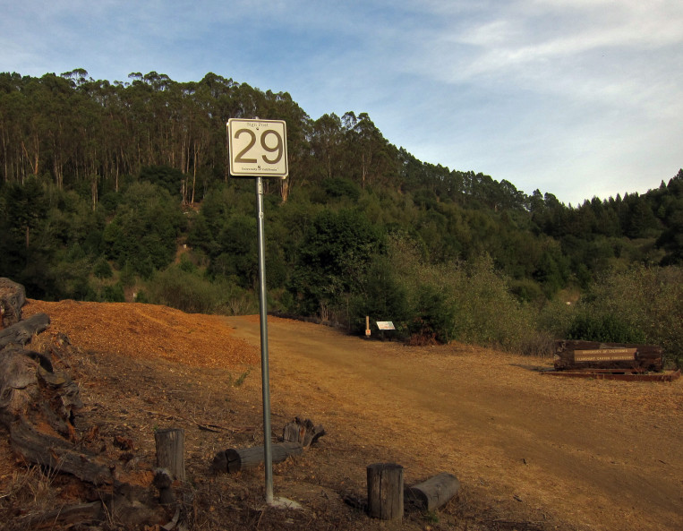
Signpost 29, in all its glory.
“At Signpost 29, you can see what a natural forest and bush area looks like,” says Jon Kaufman, president of the Conservancy, adding that redwoods have been planted over the years and highly flammable eucalyptus trees removed. “Less fire-prone species of plants now thrive there.”
He explained that eucalyptus trees from Australia were introduced on both sides of the canyon more than a century ago. People believed they would make good timber but abandoned the trees when they did not. A 1972 freeze killed them above ground; however, their stumps remained, and each one regenerated multiple trunks.
On the south side but not the north, those new trees were cut down and their stumps were treated so they would not regrow.
“The denser stands of eucalyptus on the north side crowd out the native oaks, bays, and brush by soaking up the groundwater and preventing sunlight from reaching them,” Jon said.
Summit House-Willow Loop
You will walk by those native trees and shrubs on the Summit House-Willow loop. Take either trail up and the other back down. Attractive wooden signs will keep you on track if you resist the temptation to veer onto an unmarked spur. About half way up, you’ll pass a connector between the two trails, but continue to where they actually meet, close to Grizzly Peak.

Trail map and Summit House Trail sign.
The 2/3-mile Summit House Trail is named for an inn and Pony Express stop that were nearby in the 1800s. The trail is a wide, moderately steep fire road at the bottom, but it soon narrows, ascending a total of 300 feet. It passes through a grove of coastal redwoods that volunteers planted fifty years ago in an early effort to restore the original habitat and create a more fire-resistant environment. The Conservancy added more redwood seedlings in 2000.
Willow Trail, also 2/3-mile long with a 300-foot elevation gain, is more winding, with some level sections between the steeper ones. It features many of the trees that give the path its name, some nice runs of timber steps, and several wooden bridges that span seasonal rivulets.
If you continue on the Summit House Trail past where the two trails meet, you’ll come to stairs leading to the Four Corners, the intersection of Grizzly Peak, Claremont, and Fish Ranch Road. Another map is posted at the top of the stairs to guide you, but having your own trail map always is a good idea. A helpful one is the “Tilden to Redwood Regional via Skyline Trail.”
Gwin Canyon Trail
For another hike from Signpost 29, you can do a 2.2-mile up-and-back on the Gwin Canyon Trail.

Gwin Canyon Trail.
Take the beginning of the Willow Trail and follow the sign to the Gwin Canyon Trail. The wide, new section runs through a stand of live oaks and above Claremont Creek (aka Harwood Creek). The trail is lined with blackberry and thimbleberry bushes, but beware of poison oak, thistles, and nettles.
As you climb, the trail narrows. Our heavy rainy season, coupled with more rain in May, left some upper sections with some tricky footing, so watch your step. The trail ends at the Norfolk Road cul-de-sac, where you can catch your breath before turning back to return to Claremont Avenue.
The Conservancy holds volunteer work parties on the fourth Saturday of every month, starting at 10 a.m., to clear the trails and pull invasive plants. Boy Scouts and UC students also regularly pitch in, but Jon Kaufman stresses it’s difficult to keep up with all the trail maintenance. Helping hands are always needed.
“The more people who know about these trails,” he says, “the more they’ll get used, and the better shape they’ll stay in.”
A printable map and information about Claremont Canyon, the Conservancy, and volunteer opportunities is available here.
A version of this article originally appeared in the Claremont-Elmwood Social magazine.